


Launched in 2019
Online
France
Nos Villes Vertes
Trees and the City
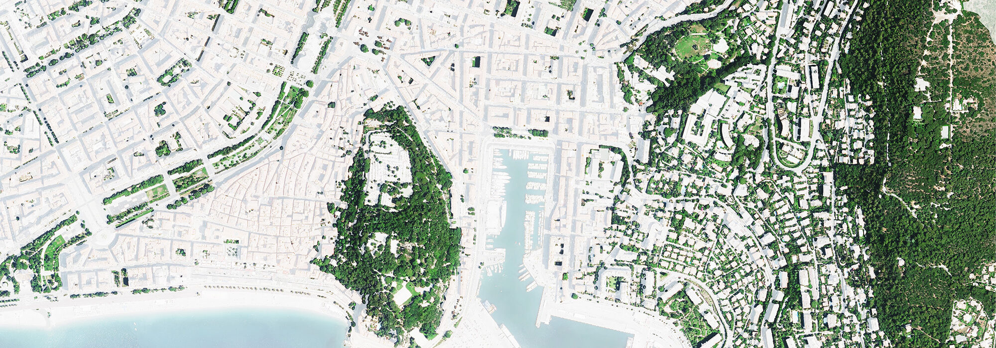
An extensive census of the tree population in France’s 36,000 towns and cities, what for ? The raw data had been available for years in national geographic institute IGN’s high-resolution aerial photographs. But it had never been processed into a synthetic platform. More often than not, even local authorities only had acess to oversimplified data. Or at best patchy as only public spaces were taken into account.
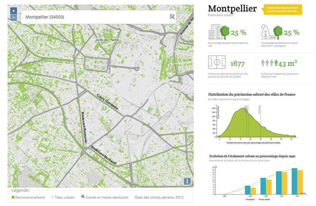
This is why we decided to make this information on urban vegetation accessible to all. We also tried to make it easier to read and comprehend, thanks to user-friendly datavisualization with simple indicators (tree coverage ratio, tree surface per capita) for each and every town in mainland France. Discover Nos Villes Vertes.
Public Interest Technology
This project illustrates our ability to use innovative AI techniques, especially deep-learning models, based on neural networks, to quickly process a huge volume of data. No less than the IGN’s whole 20-cm orthophotographic dataset, equating to 20 TB of data, was analyzed in record time.
This effort was completed during an IGNFab incubation contract, with two main goals in view. We were asked to demonstrate our technological know-how, while designing a public-interest tool. Nos Villes Vertes has met the challenge by offering everyone an opportunity to better know their area, while emphasizing the essential role played by trees in the city.