


Online
Nimbo
Nimbo: Earth map and time machine
There are various satellite imagery sources out there. But none of them equals Nimbo when it comes to combining update frequency, clearness, data diversity and easiness of use.
Nimbo Earth Online is currently the only platform providing new satellite views of the world every month, without clouds. Resolution is at 10-m/px: true, this is far less precise from what is offered by Google Earth. However, Nimbo’s satellite views have the advantage to be up-to-date, whereas the tech giant’s may be several months, sometimes even several years old.
Nimbo Earth Online is the first platform letting everyone observe our planet’s latest transformations as they happen on the ground, in the most user-friendly fashion. All of this in free access, simply by signing up at the following address: maps.nimbo.earth.
Satellite imagery made simple at last
Nimbo’s chronological views of the world are 100% developed in-house by Kermap and hosted in Europe. They rely on Sentinel 1 and 2 images supplied by the EU’s Copernicus programme, cloud-cleared and color-harmonized through exclusive deep-learning techniques for image processing (more on the topic)
A specialist in AI-driven geospatial analysis, Kermap thus reasserts its guiding ambition: making the most of innovative AI techniques and truly facilitate access to Earth observation.
Easy access to satellite data for everyone
Nimbo lets everyone explore the platform’s whole chronology of satellite images for free, and in the easiest way possible. So that more people, even not specialized in the field, can give a go at navigating geospatial imagery : students, researchers, journalists, environement or land management professionals, and of course all geography enthusiasts. All Nimbo visualizations are free to share and re-use for non-commercial purposes.
Any kind of user, even without geospatial knowledge, can explore land evolutions on Nimbo’s instantly browsable images, displayed in high resolution, thanks to super user-friendly features:
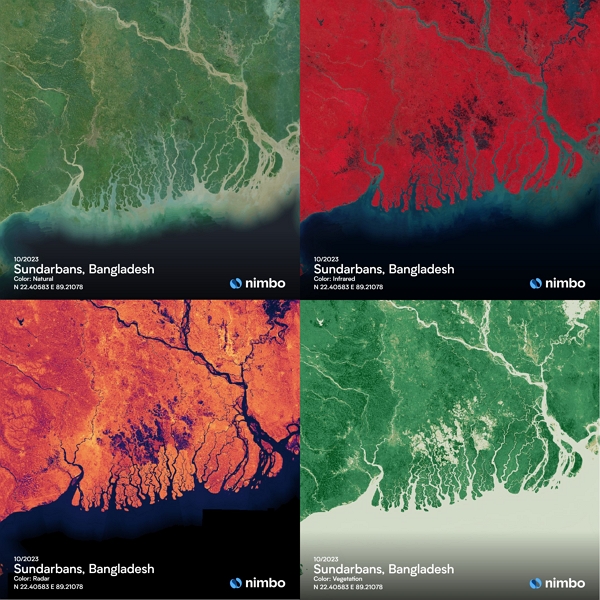
Four data layers : natural, infrared, NDVI, radar
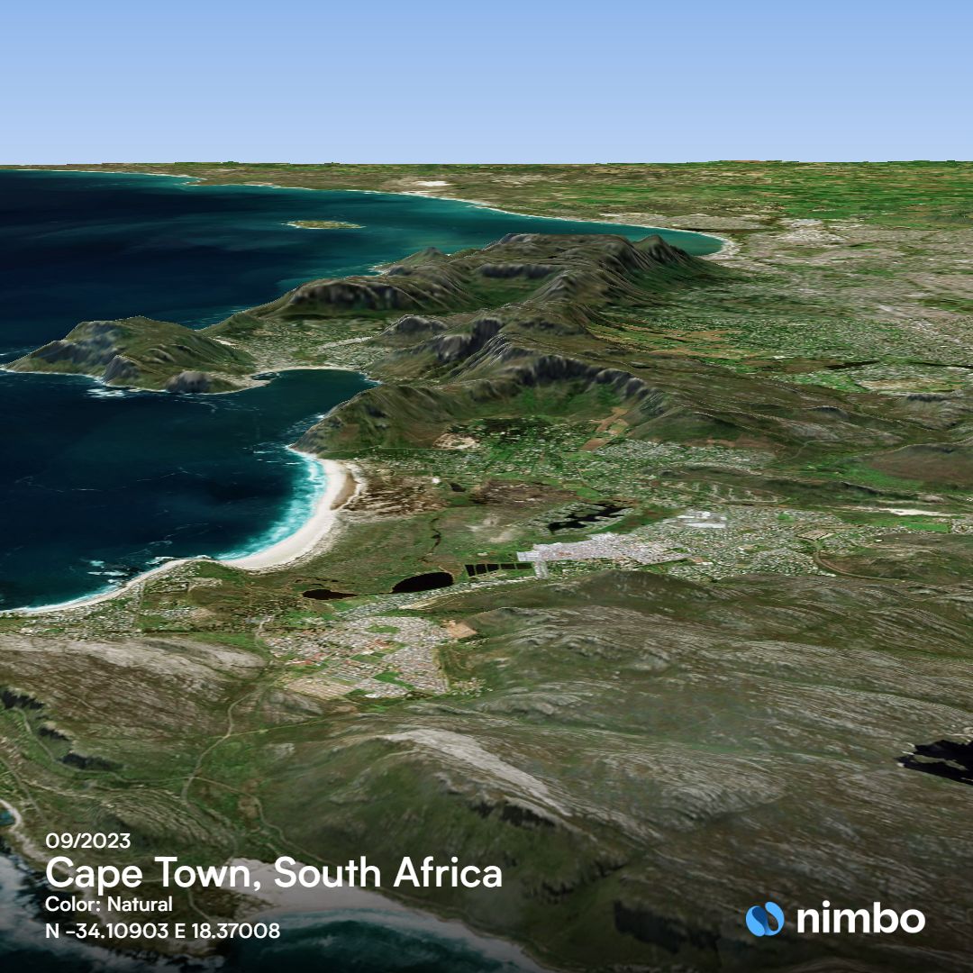
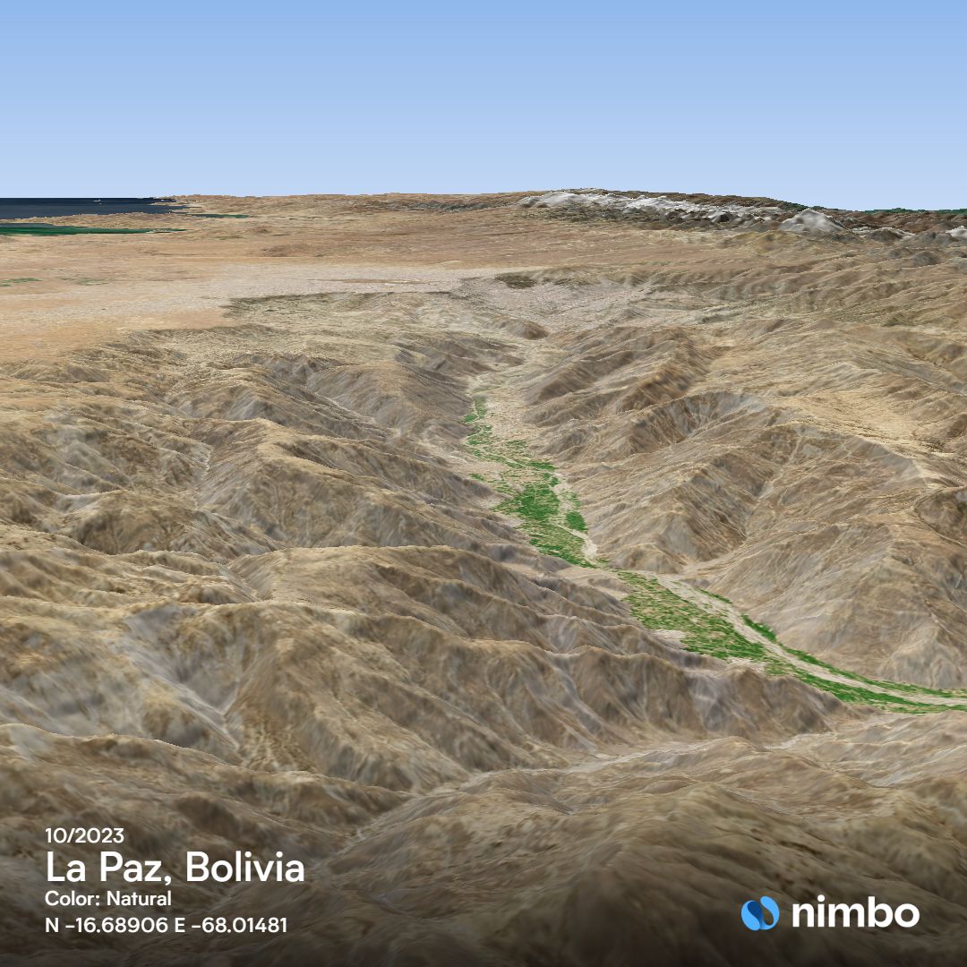
3D view, worldwide, every month
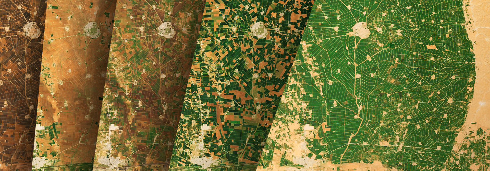
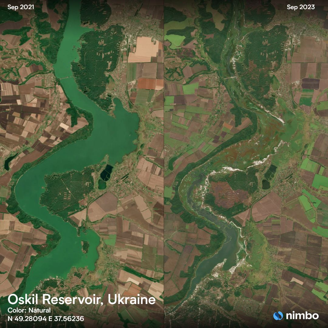
Split & Swipe : compare images from different months
Timelapse creation : generate animations on-the-fly
High-quality world basemaps for GIS professionals
Nimbo’s Earth Basemaps clarity and homogeneity make them ideal for geospatial applications based on machine learning: time series analysis, object extraction, change detection… That is why the Nimbo experience also includes access to basemap products designed for geospatial analysis professionals.
Any layer from any month among the nearly 200 basemaps already produced since October 2019 can then be easily retrieved and worked upon.
These products are distributed in standard OGC formats (TMS, WMS), making them compatible with any GIS software. Using the API token available from their Nimbo account, GIS specialists can easily import these basemaps into QGIS (with the Nimbo QGIS plugin) or ArcGIS for instance, or even feed them into their proprietary geospatial apps.
Leveraging EO and AI to support climate action
As all eyes are on the rapid and unsettling transformations brought about by climate change, space data is one of the most precious resource at our disposal to measure, predict, adapt to and counter these phenomena.
Kermap provides the first solution granting universal access to these crucial information, through visualization and analytics extraction. With Nimbo, the invaluable wealth of information contained in space imagery is truly unlocked at last to support today’s and tomorrow’s climate and environmental actions.